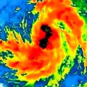
A powerful bomb cyclone is forming off the West Coast, rapidly intensifying through a process called bombogenesis. Meteorologists predict the storm’s pressure will drop 20-24 millibars within 24 hours by Tuesday, November 19, signaling a severe event.
The storm’s atmospheric river will bring torrential rain and significant snow, particularly in Northern California and Oregon. Some areas could see 8-12 inches of rain, with isolated spots receiving up to 15 inches. Mountain regions, including the Cascade and Siskiyou ranges, may experience several feet of snow, with snow levels rising through the week, complicating travel.
Flood risks are high in areas with poor drainage, recently burned regions, and rivers likely to overflow. Mountain passes, such as Siskiyou Pass on I-5 and Snoqualmie Pass on I-90, will face challenging driving conditions, compounded by rockfalls and landslides.
Wind gusts of 60-70 mph will batter the coast, with inland areas also experiencing damaging winds. Power outages are likely due to fallen trees and debris. Gusty conditions will persist through the week, even after the storm’s peak.
Mariners face life-threatening conditions, with waves reaching 21-26 feet and wind gusts up to 70 knots. The National Weather Service advises seafarers to avoid sailing and secure vessels to prevent accidents.
Prepare now for dangerous conditions, as the storm will significantly impact the region.


